
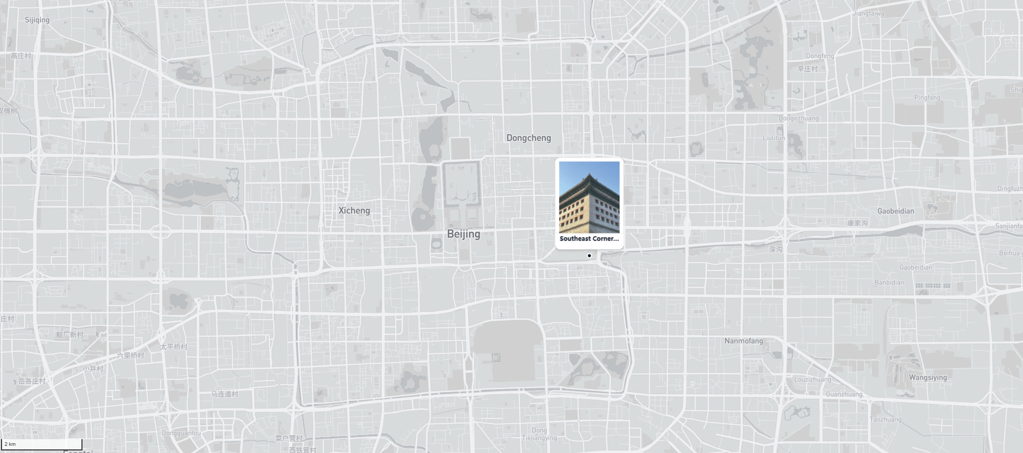
The Southeast Corner Tower - Where Trains Brush the Eaves

Standing by the East Second Ring Road at Dongbianmen, passenger trains slip in and out of Beijing Railway Station, their carriages almost grazing a brick giant that predates the locomotive by four centuries. Above the traffic, the Southeast Corner Tower lifts its green-tiled eaves, and for a moment the present tightens around the past. Few places in Beijing show modern and ancient so close together, frame by frame. Trains pass the corner tower; the old inner-city wall bends, then continues as a park; the ring road draws a circle where ramparts once stood.
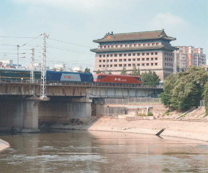
Walk toward the tower and your eye adjusts to its scale and logic. This is the last intact corner tower of the Ming inner city, built in the 1430s when the capital’s fortifications were re-laid in brick over rammed earth. It rises about 29 meters and is riddled with 144 archery windows, a gridded facade that reads like a military diagram. Inside the shell, heavy timber frames carry floors and roof loads, an anatomy typical of Ming defensive buildings: brick presents the hard face to siege, wood handles span and shock. Ramps within let soldiers and horses move quickly to firing positions. The double eaves, tiled in green, add both weather protection and authority, softening the mass without hiding its purpose.

Just below runs the Tonghui River, the historical waterway that linked the old Grand Canal to the heart of Beijing. Grain, silk, and salt that traveled north across provinces reached their last urban stretch here; taxes and inspections once made the nearby gates the busiest portals in town. Even if the cargo boats are long gone, the geometry remains: wall above, sluices and moat below, and the canal’s story sliding in under stone.
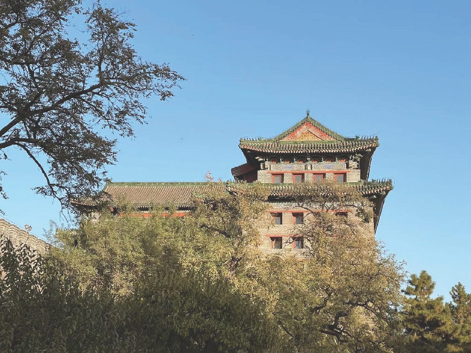
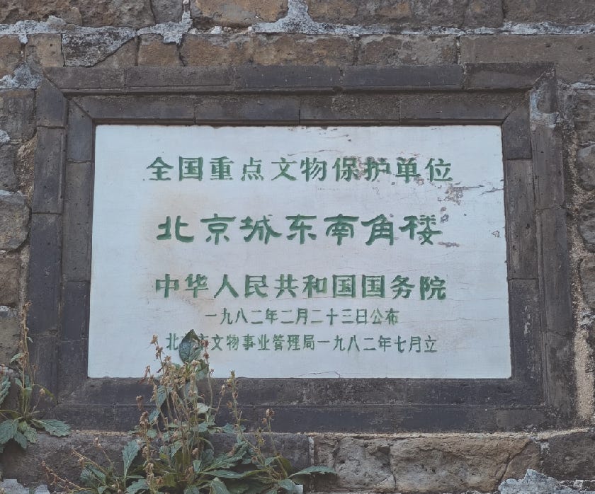
To read the wall is to read the city’s origins in the early 15th century. After the Yongle emperor moved the capital north, builders standardized a defensive system around height, thickness, and rhythm: an inner city of about 40 kilometers in perimeter, faced with brick, backed with compacted earth, and crowned by crenellations. The Southeast Corner Tower formed one of the four great anchors of that circuit. Today most of that loop is gone, but this 1.5-kilometer remnant—the longest surviving section—still runs from Chongwenmen to Dongbianmen.

The City Walls Came Down
From the early 1950s, Beijing’s leaders faced a blunt problem: an inward-facing walled capital had to become a motorized national center. Traffic jammed at gate bottlenecks; freight yards and the Tonghui River corridor pressed on the southeast quadrant; and new ministries and housing had to fit inside a fixed medieval frame. Piece by piece the solution shifted from widening gates to removing barriers. Through the 1950s, sections of the Outer City wall went first; by the late 1950s the Inner City wall was targeted more systematically. A notable pause came on June 11, 1957, when the State Council forwarded a Culture Ministry report instructing Beijing to “temporarily suspend demolition” and consult widely, a rare central-level document showing hesitation. Local minutes that summer even floated “keep the Inner City, strip bricks from the Outer City,” but by 1958 the momentum turned back toward removal under a broader mandate to “remake” the capital. In the decades that followed, the newly cleared strip hardened into infrastructure: the Second Ring Road tracked the old moat line, and much of Subway Line 2 settled beneath it, converting a defensive perimeter into a circulatory loop.
There was, however, a different path on the table. In 1950, architects Liang Sicheng and Chen Zhanxiang proposed moving the new administrative center to the west of the old city, while preserving the walled core and adapting its belt as public green and light-traffic streets. Their “two-center” idea would let the historic city read as a museum-like ensemble with walls, gates, hutong fabric, while a modern district grew alongside it. The plan lost in committee, and later retellings sometimes magnify it into a simple “what if,” but the core is clear: separate growth from heritage instead of forcing one to consume the other. In the years since, scholars inside and outside China have treated the demolition as one of Beijing’s deepest planning regrets, less a technical necessity than a political and conceptual choice. That regret fuels the care now lavished on what remains: the Southeast Corner Tower, the 1.5-kilometer wall segment and green belt of the Ming City Wall Ruins Park, and the renewed attention to the Tonghui River as the Grand Canal’s final approach into the city. In this light, Corner Tower is not just a picturesque collision of train and eaves; it is a margin where two models of Beijing meet.
If my insights brought you a fresh perspective, please consider supporting me by buying me a coffee. Your generosity fuels my writing.

Marvellous, Jingyu. I was ready to read more and more, but the article ended to soon! Would love a new post with more info about this national planning regret.
Another reason I love Suzhou. As early as 1959 Suzhou's urban plan was aimed at traditional industries and tourism; and despite rapid urbanisation and economic development in the 70s and 80s in 1982 Suzhou was listed as a national historical and cultural city, with the aim of preserving the ancient city. Although many of the waterways had been filled in and the city walls destroyed, much remained -- many canals still exist, the old white walled houses are prominent in the old city, and there are still some City Gates in existence. More than any other city (including Xian with its city walls still intact) Suzhou feels like its ancient planning is still alive.
Great as usual.